We’re thrilled to introduce yet another new feature on ZoomProspector: adjustable drive time analysis for cars, trucks and walking. This is a game-changer for prospective investors who need to assess transportation logistics, commute times and travel distances for target clients travelling in different ways, on different days and at different times. In keeping with GIS Planning’s ongoing commitment to excellence in the user interface, we’ve designed this feature to be intuitive, visual and easy for your website visitors to find.
The new drive time analysis is easy to find – it’s an enhancement of the radius/ drive time buttons at the top of every single property and pinpoint report. Now when you click “Minutes,” you’ll see icons that let you select car, truck or walk, with an additional option to click on and adjust the date, time and destination – from or to the selected location. We’ve made it even easier by also adding these options directly on the map for those website visitors who prefer to make adjustments over there.
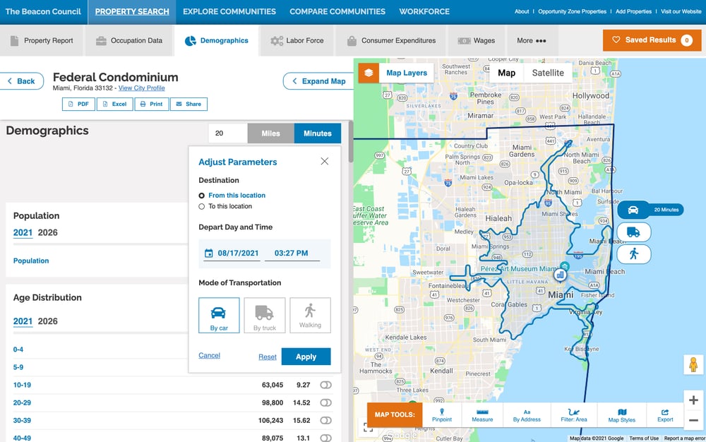 It’s easier than ever for economic developers to inform site selectors and businesses making location decisions as they research long and shortlists of suitable communities and properties. You can read more about our new adjustable drive time analysis here. You can also click here to learn more about the other map tools that make ZoomProspector the most innovative and user-friendly online GIS data tool for site selection?
Would you like to learn more about how ZoomProspector can help drive investment to your community? Click here to schedule an online meeting and demo.